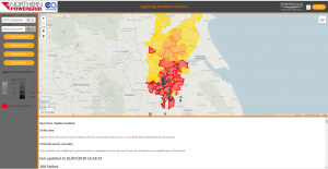
MAP Lightning – Predict lightning risk by postcode sector using real time lightning strike data
MAP Lightning predicts the the path of lighting strikes for the next hour and displays the risk for each postcode sector in the direction of travel. Risks are updated every minute as new real time strike data is imported and the algorithm takes into account the historic strike density per km2 and increase/decrease in strikes over the preceeding 15 minutes.
MAP Lightning is built using the Meniscus Analytics Platform and delivered with our partner EA Technology
Key features of the service
Key features of the dashboard

