MAP Rain – New FEH 2013 Rainfall Return Period calculator
FEH is the industry standard used to estimate local flood risk and develop resilient infrastructure.
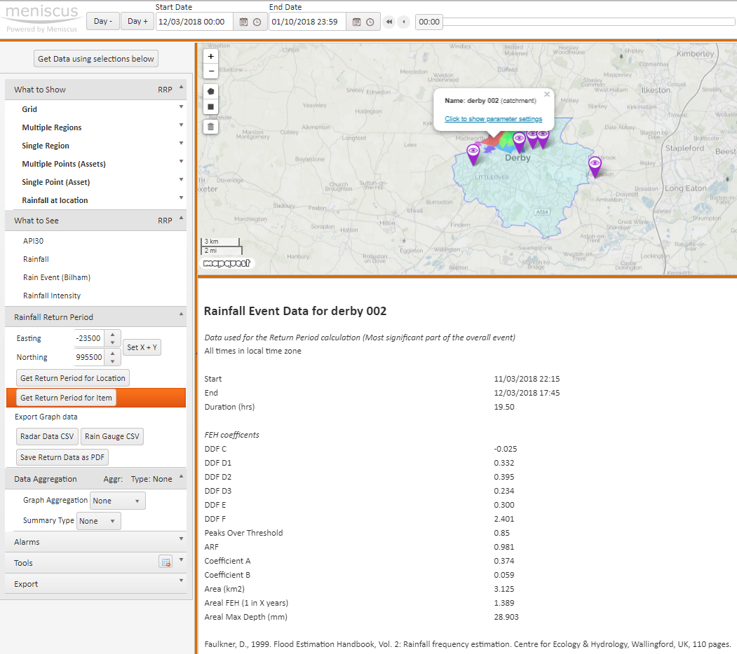
New Service – Rainfall Return Period calculation for any location using the FEH 2013 methodology
MAP Rain dashboard and rainfall map now includes the updated FEH (Flood Estimation Handbook) 2013 methodology as well as the original FEH99 method. This provides the Return Period calculation for any location and any date in the past 4 years using the MAP Rain dashboard. These Return Period calculations are available for both Points and Polygons.
You can use the MAP Rain dashboard to calculate:
For more information on our MAP Rain dashboard and rainfall map click here
Predicted Rainfall Alerts
MAP Rain can also apply the FEH 2013 methodology to the forecast rainfall so that we can send you e-mail alerts for any significant rain events that may impact flooding hotspots.
Return Period calculation API calls
We have built two API calls into MAP to let you integrate the FEH 2013 return period calculations directly into your own applications. Please note that these call will take about 2 minutes to return.
Returns depth (mm), duration (hours) and Return Period for a particular day and location
Inputs
Date 17th Sept 2017 (rainy day)
Location in Long Lat (WGS84) or OS Easting and Northing
Returns
Rain Event Start and End Time 14:30 to 16:00
Duration 1.5 hours
Max Depth 16.68 mm
Return Period 1 in 2.45 years
Returns depth of rain (mm) for a specific duration (hours), return period and location
Inputs
Location in Long Lat (WGS84) or OS Easting and Northing
Duration 5 hours
Return Period 1 in 20 years
Returns
Max Depth 47.72 mm
Acknowledgement
FEH Return Periods calculated by Meniscus through use of FEH1999 and FEH2013 DDF model © and Database right NERC (CEH).
Stewart, E. J.; Jones, D. A.; Svensson, C.; Morris, D. G.; Dempsey, P.; Dent, J. E.; Collier, C. G.; Anderson, C. A.. 2013 Reservoir Safety – Long Return Period Rainfall. Project FD2613 WS 194/2/39 Technical Report (two volumes). Joint Defra/Environment Agency Flood and Coastal Erosion Risk Management R&D Programme.